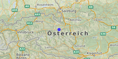
 Embach (1035 m) Heuberg, Winkl
Einloggen, um einen Kommentar zu verfassen
The other end
-
Cyclopaat, 10.12.2021, 06:58 Uhr 10.12.2021, 06:59 UhrThere's an unlisted ascend from the other end, starting at/near Taxenbach. It's a nasty 8,3 km at an average of 3,7%. However, as there's a descend in the middle, the climbing average is closer to 8%, maxing out at 18%...
-
Jan, 11.12.2021, 13:02 Uhr 11.12.2021, 13:06 UhrYes, this climb should be added to the pass.
The idea nowadays is that you add this climb yourself. To this end we can give you access to the admin panel of the pass.
The way to proceed is described in two blog posts
https://www.quaeldich.de/blog/qualitaetskriterien-des-quaeldich-paesselexikons/
https://www.quaeldich.de/blog/so-kannst-du-paesse-bei-quaeldich-de-beisteuern/
All in German obviously. Have you ever tried our trip planner?
https://tourenplaner.quaeldich.de/
If not it's a bit much for a start. Maybe someone could help out and create this climb for @Cyclopaat ?
@Torsten maybe? :]
Yours, Jan -
Cyclopaat, 11.12.2021, 13:21 UhrHi Jan
I'll have a look. So far, I've only been asked to throw a GPX file over the wall and someone else would do the rest.
I wouldn't mind doing (more of) it myself. In this case, the climb is in a 200 km long track, which may make it hard to find ?
Robert -
Jan, 11.12.2021, 18:19 Uhr 11.12.2021, 18:20 Uhr auf CyclopaatHi Robert,
In this case no GPS-juggling is involved. The track already exists in the trip planner, so just a qdtp-file has to be created following the climb from Taxenbach to the pass, which is a two-click-no-brainer.
Having said that I see no more excuses for not creating the climb myself. Done:
https://www.quaeldich.de/paesse/embach-pass/#nordwestanfahrt-von-taxenbach
You can now claim this pass for Passjagd :)
Anyone in for a detailed description?
Yours, Jan -
Cyclopaat, 11.12.2021, 18:32 UhrThanks Jan - I'll get into the specifics of how to do this anyway ?
Also, I claimed it.
Robert -
Torsten, 11.12.2021, 22:49 UhrHi Guys!
The road from Taxenback up to so called Rauriser Höhe is the fist part (2.7 km). Then there is a short descent to the bridge, where the road goes ahead for Rauris and left to Embach. To Rauris and ahead the road goes to "Rauriser Tal (Kolm-Saigurn)". I'm not sure, but maybe the track should start at the bridge.
And: I cycled this road many times, I can easily write a description for that.
Cheers, Torsten -
Cyclopaat, 12.12.2021, 06:15 UhrDuring 2017's Marmotte, it started at the Taxenbach bridge and there was a 8300m sign for it. Imho, the entry is good as it is now, so with the drop. There are more climbs - albeit most of them a lot longer, that have this. Like the Croix de Fer or the Nockalmstrasse...


